Satellite images indicate Israel entrenching a permanent military presence in Gaza

21 December, 2025 09:58
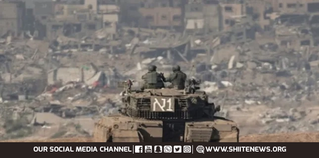
The Israeli regime appears to be laying the groundwork for a permanent military presence in large parts of the Gaza Strip, according to a new satellite imagery analysis that documents extensive construction, infrastructure expansion, and continued destruction of Palestinian property since a ceasefire took effect in October.
Research released by Forensic Architecture, a multidisciplinary research group, and published by the Drop Site News outlet on Saturday showed that the regime had built at least 13 new military outposts inside Gaza since the ceasefire came into force on October 10, while accelerating the expansion and consolidation of 48 existing outposts.
The findings suggested that Israeli forces were not merely holding temporary positions, but physically reshaping the territory in ways consistent with long-term control.
The analysis, based on satellite images from October 10 to December 2, indicated that the regime now maintained a dense network of military infrastructure east of the so-called “yellow line,” a supposed partial withdrawal boundary established under the ceasefire.
Researchers found that Israeli forces currently controlled more than half of Gaza and had continued to extend that control through construction and demolition activity.
According to Forensic Architecture, the regime has expanded road networks linking military outposts inside Gaza to Israeli bases, roads, and illegal settlements outside the coastal sliver, reinforcing logistical integration between occupied areas in Gaza and the occupied Palestinian territories.
The group also documented continued construction of a new road in Khan Younis in southern Gaza that reroutes the regime’s Magen Oz military corridor to run entirely within areas controlled by the regime.
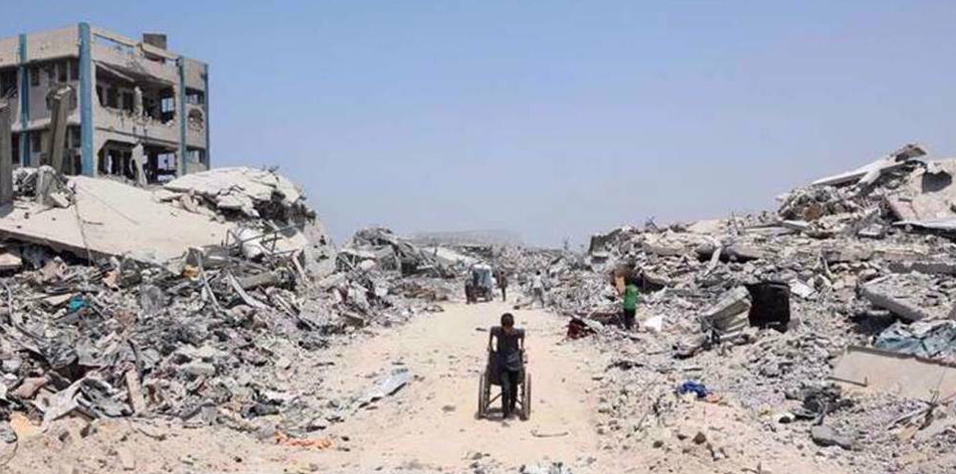
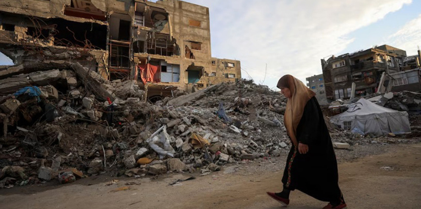
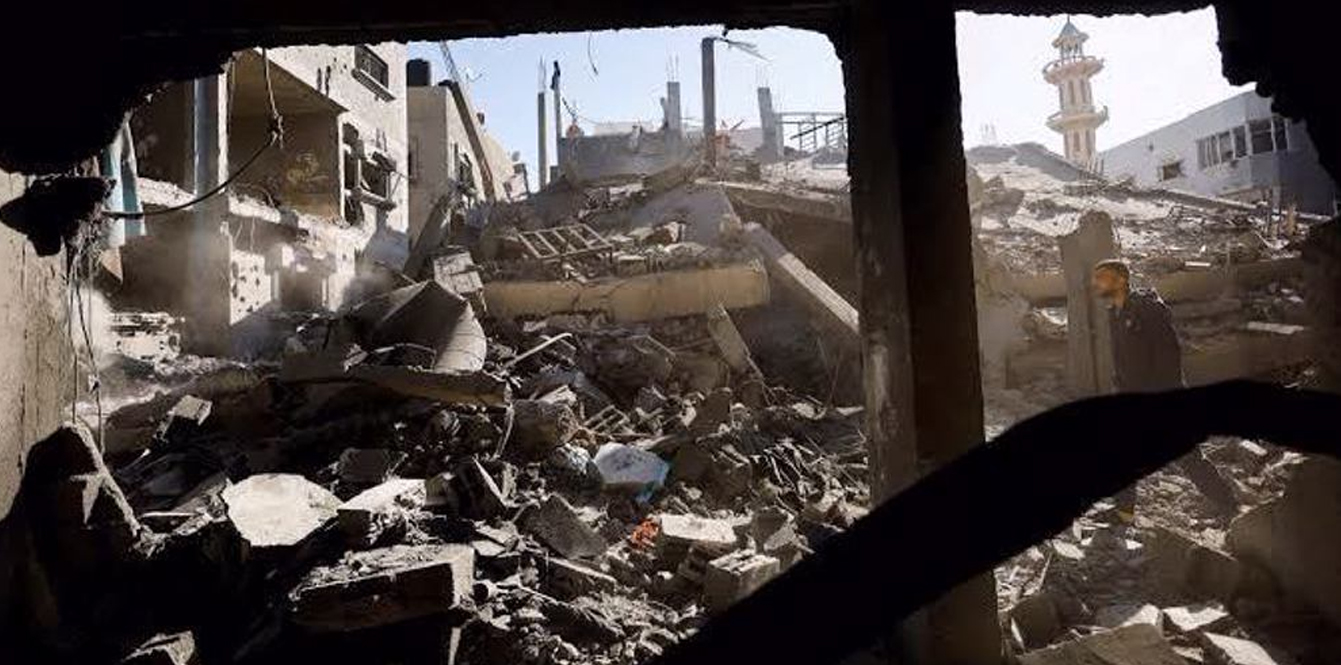
Military expansion has been accompanied by systematic destruction of Palestinian property, particularly in eastern Khan Younis and elsewhere in southern Gaza, including Rafah.
Buildings that had not previously been destroyed were demolished after the ceasefire, while new outposts and military roads were constructed across the same areas.
One case study cited in the report detailed a newly established Israeli outpost in Jabaliya in northern Gaza, where a densely populated tent area was dismantled and surrounding buildings were razed.
Satellite imagery and ground photographs showed construction of roads, large militarized berms, and new structures on elevated ground east of the “yellow line,” overlooking areas where Palestinians were forcibly displaced.
Mouin Rabbani, a former United Nations official and senior analyst on Israeli-Palestinian issues, said the findings aligned with the regime’s historical approach of creating irreversible realities on the ground.
He told Drop Site News that Tel Aviv had consistently pursued incremental steps that become permanent once international pressure faded or political costs were deemed manageable.
Under the initial phase of the ceasefire linked to US President Donald Trump’s so-called 20-point Gaza plan, Israeli forces were to withdraw to the “yellow line,” leaving between 53% and 58% of Gaza under Israeli control, according to official maps released by Washington and later by the Israeli military.
However, Forensic Architecture found that since the ceasefire, the regime had seized additional land by placing at least 27 physical markers west of the “yellow line” shown on its own maps.
Trump’s plan states that the regime would not occupy or annex Gaza and that its forces would eventually withdraw as an “International Stabilization Force” takes over.
The report concluded that through expansion of outposts, integration of road networks, and continued demolition of Palestinian neighborhoods, the regime was entrenching a presence that went beyond temporary “security measures” and suggested a permanent role on the ground in Gaza.
Must Read